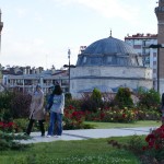
June 30th – 6 Wochen Türkei (Teil 5) – Region Kara Deniz
-
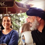
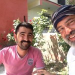
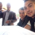
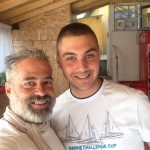
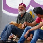
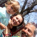
- Elifhanim & Arturbey
-
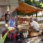
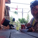
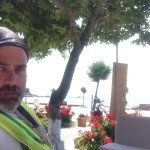
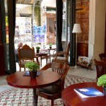
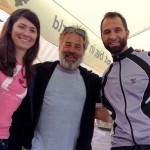
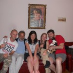
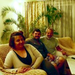
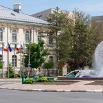
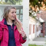
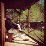
- Elifhanim, Arturbey and Matthias at the terrace of „Adelante Hostel“ in Trabzon
-

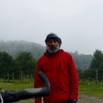
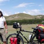
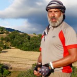
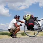
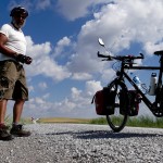
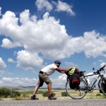
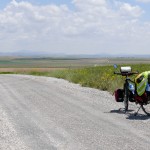
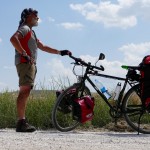
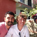
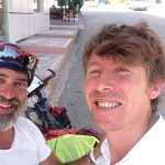
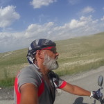
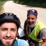
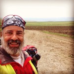
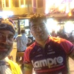
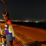
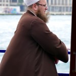
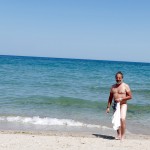
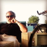
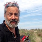
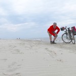
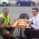
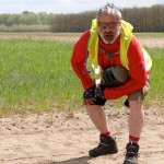
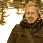
- Mathias, a Berliner cyclist from Freiburg in Germany pedalling with me together. His Goal: reach New Zealand, (www.projekt-akaroa.de)
-
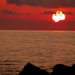
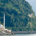
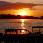
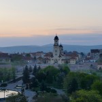
- Sunset in Rize (TR)
-
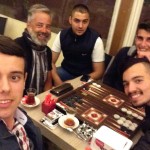
- a late Tavla match with Mustafa
-
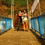
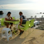
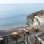
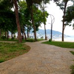
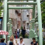
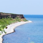
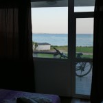
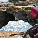
- Stairways to the beach
-
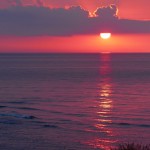
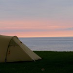
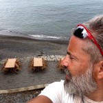
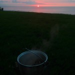
- Sunset at the Black Sea, Ünye.
-
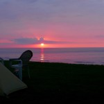
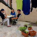
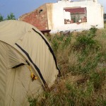
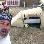
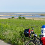
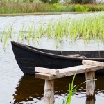
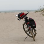
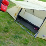
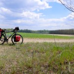
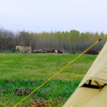
- My campsite at Ünye / Black Sea
-
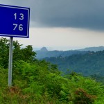
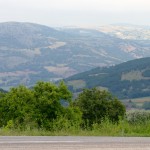
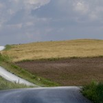
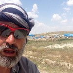
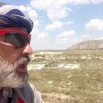
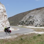
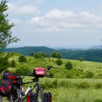
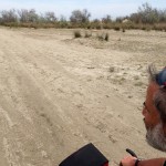
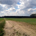
- Crossing the CANIK DAGLARI (Mountain range within the Pontic Mountains)
-
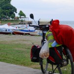
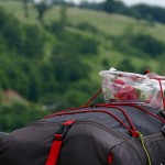
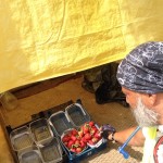
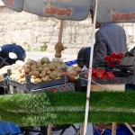
- At Ünye (see my Mushroom bag 🙂 )
-
- My campsite at Ünye
-
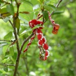
- Oh Lord, have you been here when you designed the paradise? Chestnuts, Plumb-threes, Black-Berries, Red Currants, and many more fruits
-
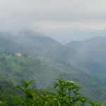
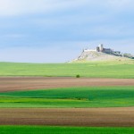
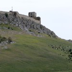
- Crossing the CANIK DAGLARI (Mountain range within the Pontic Mountains) about 1200 MSL
-
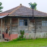
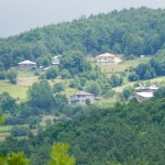
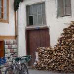
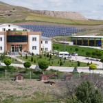
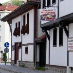
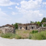
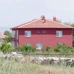
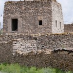
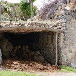
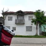
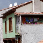
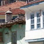
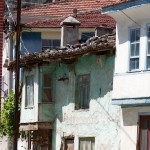
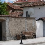
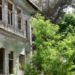
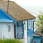
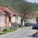
- A typical House in this mountainous region.
-
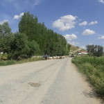
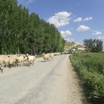
- Crossing the CANIK DAGLARI (Mountain range within the Pontic Mountains) Entering the stau area.
-
- Crossing the CANIK DAGLARI (Mountain range within the Pontic Mountains) short of the Stau situation.
-
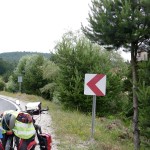
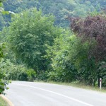
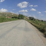
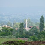
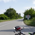
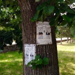
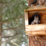
- didi you see the birds house hanging below the tree?? NO, it;s not Switzerland, its not Austria, it’s somewhere along the ROAD 850 between Niksar and Ünye in Turkey.
-
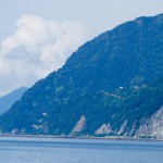
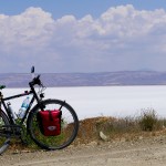
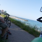
- Kara Deniz (Black Sea) between Ünye and Ordu.
-
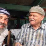
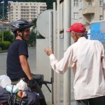
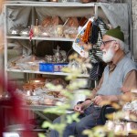
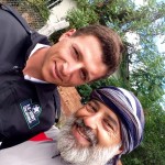
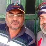
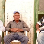
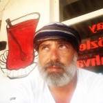
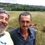
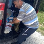
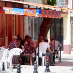
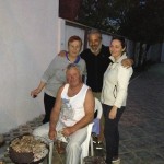
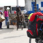
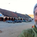
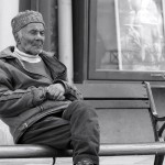
- At Yaliköy, this man is the car mechanic of the village, former taxi driver in Germany (Bremen) and as second occupation, he is the editor of the YALIKÖY NEWSPAPER ( A monthly issue and by the way, he will publish this picture with the foreigner, telling that I get in love in Turkey but I define the turkish behaviour with the environment as a shame.
-
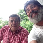
- …and he is the Mayor of the village.
-
- The family of the Car mechanic and Newspaper editor.
-
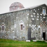
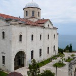
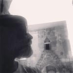
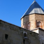
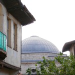
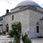
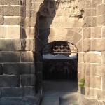
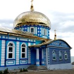
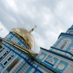
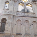
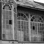
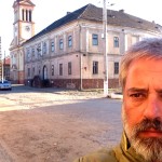
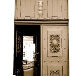
- JASONS CHURCH at the Çaytepe village. A ancient greek church
-
- JASONS CHURCH at the Çaytepe village. A ancient greek church
-
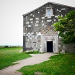
- JASONS CHURCH at the Çaytepe village. A ancient greek church
-
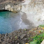
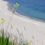
- Black Sea between Bolaman and Yaliköy. The Beach
-
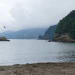
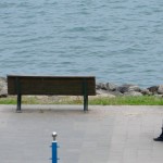
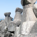
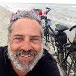
- The shore of the Black Sea, on a misty day, leaving Ünye.
-
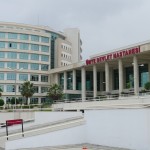
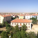
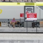
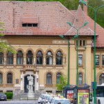
- The public hospital of Ünye.
-
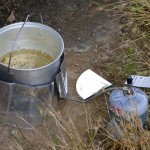
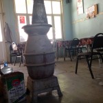
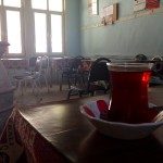
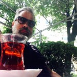
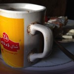
- The Çay Stove smoking on a misty day.
-
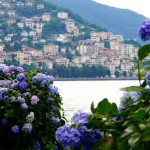
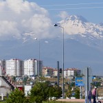
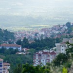
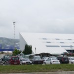
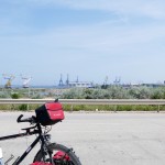
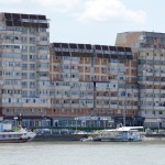
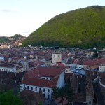
- Ordu, the 200.000 people city on the Black Sea coast.
-
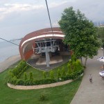
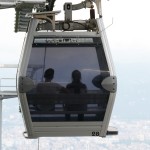
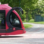
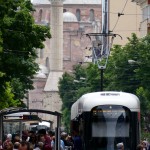
- The Ordu Boztepe Gondola can transport hourly 900 passengers up to the hilltop in 6.5 minutes
-
- turning back, down to earth.
-
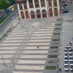
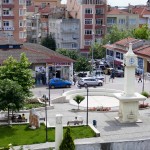
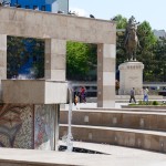
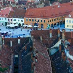
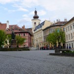
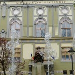
- Twonhall Square in Ordu
-
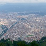
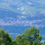
- View from the Boztepe Hill down to Ordu
-
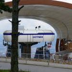
- Leitner Ropes also in Ordu. Boztepe – a hill of 550 m (1,800 ft) overlooking the town from the west. Since June 2012, an aerial lift system provides an easy way of transportation between the city’s coastline and the hilltop. The Ordu Boztepe Gondola can transport hourly 900 passengers up to the hilltop in 6.5 minutes
-
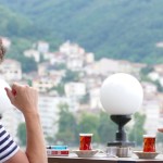
- turkish beauty. No comment.
-
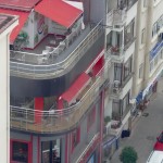
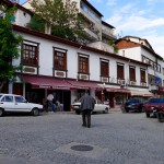
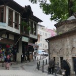
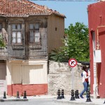
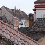
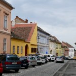
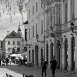
- Innercity.
-
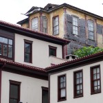
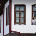
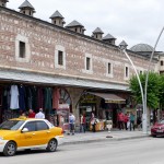
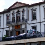
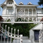
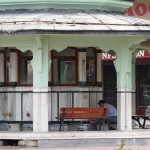
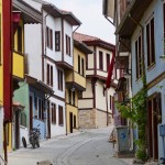
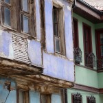
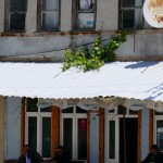
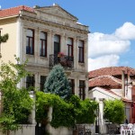
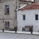
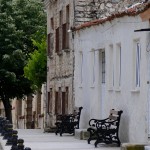
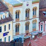
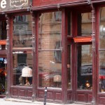
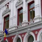
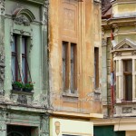
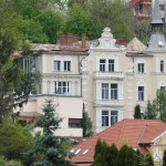
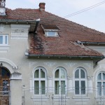
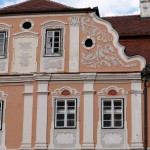
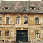
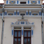
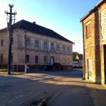
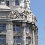
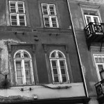
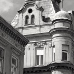
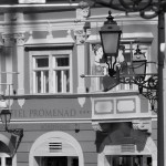
- Old and restored. Classic Ottoman Style.
-
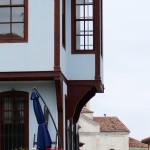
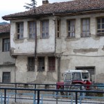
- An old Ottoman Villa
-
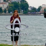
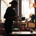
- Newsreader, last check before she goes on air.
-
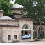
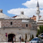
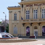
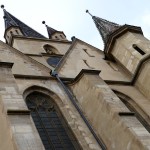
- Taşbaşı Cultural Centre, former a Catholic Greek Orthodox Church.
-
- Ordu, a mixture of tradition and modernity. Openminded and self-confident.
-
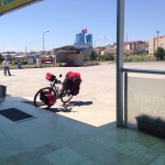
- Arriving at Trabzon
-
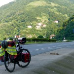
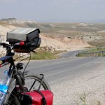
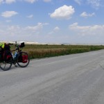
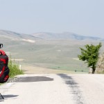
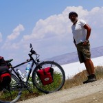
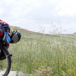
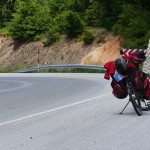
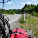
- a Break on the road
-
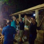
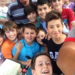
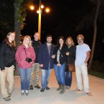
- dancing folklore with Ahmed friends and family at Kesap.
-
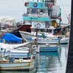
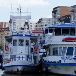
- The fisher’s port at Espiye
-
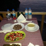
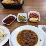
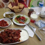
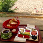
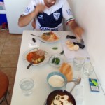
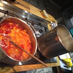
- a classical turkish dinner (lunch) The soup, chillies, tomato and cucumber salad as well a hot dip is usual. Homemade bread, rice and a lamb stew. The classical drink is Ayran, a mixture of Joghurt, Water and Salt, ice-cold served.
-
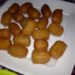
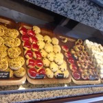
- Vaclava, sweets for after dinner
-
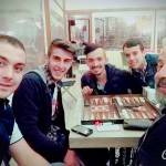
- Playing Backgammon with Ahmed’s brother.
-
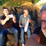
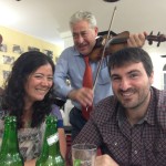
- A home concert of folklore at sunset
-
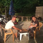
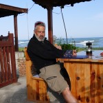
- playing Tavla (Backgammon) with Ahmed, the owner from the Gulak Camping Cafe
-
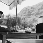
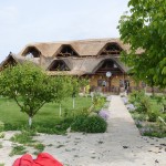
- the Gulak Camping Cafe
-
- the Gulak Camping Cafe
-
- the Gulak Camping Cafe
-
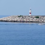
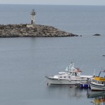
- Black Sea, Lighthouse
-
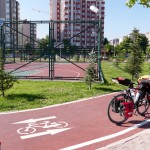
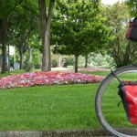
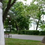
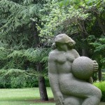
- Urban development (one of hundreds o Parks) in Ordu
-
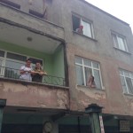
- …. as stronger the faith and bigger their Churches.
-
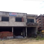
- As bigger the underdevelopment of a region or city….
-
- Ordu
-
- a classical turkish dinner (lunch) The soup, chillies, tomato and cucumber salad as well a hot dip is usual. Homemade bread, rice and a lamb stew. The classical drink is Ayran, a mixture of Joghurt, Water and Salt, ice-cold served.
-
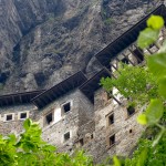
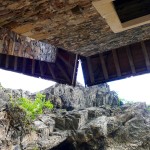
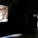
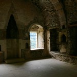
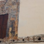
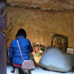
- The entrance to the Monastery leads up a long and narrow stairway. There is a guard-room next to the entrance. The stairs lead down from there to the inner courtyard. On the left, in front of a cave, there are several monastery buildings. The cave, which was converted into a church, constitutes the center of the monastery. The library is to the right.
-
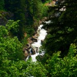
- Looking down to the valley.
-
- The entrance to the Monastery leads up a long and narrow stairway. There is a guard-room next to the entrance. The stairs lead down from there to the inner courtyard. On the left, in front of a cave, there are several monastery buildings. The cave, which was converted into a church, constitutes the center of the monastery. The library is to the right.
-
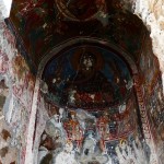
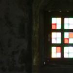
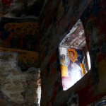
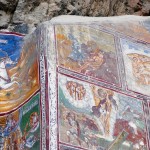
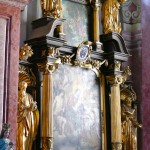
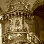
- The inner and outer walls of the Rock Church and the walls of the adjacent chapel are decorated with frescoes. Frescoes dating from the era of Alexios III of Trebizond line the inner wall of the Rock Church facing the courtyard. The frescoes of the chapel which were painted on three levels in three different periods are dated to the beginning of the 18th century. The frescoes of the bottom band are of superior quality.
-
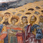
- The main subject of the frescoes are biblical scenes telling the story of Christ and the Virgin Mary.
-

- The main subject of the frescoes are biblical scenes telling the story of Christ and the Virgin Mary.
-
- The inner and outer walls of the Rock Church and the walls of the adjacent chapel are decorated with frescoes. Frescoes dating from the era of Alexios III of Trebizond line the inner wall of the Rock Church facing the courtyard. The frescoes of the chapel which were painted on three levels in three different periods are dated to the beginning of the 18th century. The frescoes of the bottom band are of superior quality.
-
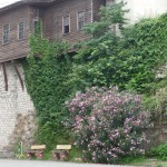
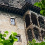
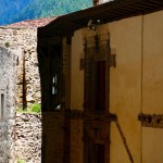
- The large building with a balcony on the front part of the cliff was used for the monks‘ cells and for housing guests. It dates from 1840.
-
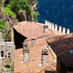
- The large building with a balcony on the front part of the cliff was used for the monks‘ cells and for housing guests. It dates from 1840.
-
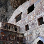
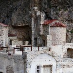
- The principal elements of the Monastery complex are the Rock Church, several chapels, kitchens, student rooms, a guesthouse, a library, and a sacred spring revered by Eastern Orthodox Christians.
-
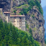
- The monastery was founded in AD 386 during the reign of the Emperor Theodosius I (375 – 395) During its long history, the monastery fell into ruin several times and was restored by various emperors. During the 6th century, it was restored and enlarged by General Belisarius at the behest of Justinian. It reached its present form in the 13th century after gaining prominence during the existence of the Empire of Trebizond. In 1682 and for the following decades, the monastery housed the Phrontisterion of Trapezous, a well-known Greek educational institution of the region.
-
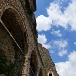
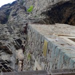
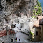
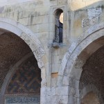
- The large aqueduct at the entrance, which supplied water to the Monastery, is constructed against the side of the cliff. The aqueduct has many arches which have mostly been restored.
-
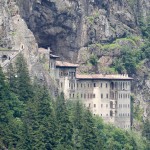
- The Sumela Monastery (Turkish: Sümela Manastırı) is a Greek Orthodox monastery dedicated to the Virgin Mary at Melá Mountain within the Pontic Mountains range, in the Maçka district of Trabzon Province in modern Turkey. Nestled in a steep cliff at an altitude of about 1,200 metres (3,900 ft) facing the Altındere valley, it is a site of great historical and cultural significance, as well as a major tourist attraction within Altındere National Park.
-
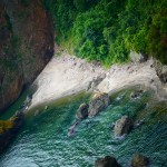
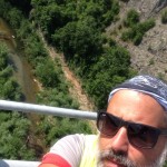
- The Çoruh River (Turkish: Çoruh, Georgian: ჭოროხი ch’orokhi, Greek: Άκαμψις, Akampsis Armenian „Ճորոխ“- (Tchorokh)) rises in the Mescit Mountains in north-eastern Turkey, flows through the cities of Bayburt, Ispir, Yusufeli, and Artvin, along the Kelkit-Çoruh Fault, before flowing into Georgia, where it reaches the Black Sea just south of Batumi and a few kilometers north of the Turkish-Georgian border.
-
- Close to Batumi
-
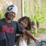
- A Japanese couple, cyclists as well, heading Turkey and Europe
-
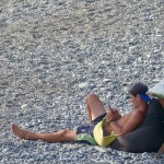
- The lifeguard keeping care of the swimmer
-
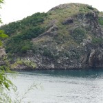
- A last view back to Turkey from the Georgian side of the border.
-
- Mathias having a small talk on a cross road
-
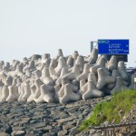
- The border region between Turkey and Georgia at the Black Sea
-
- Dinner for One
June 30th – 6 Wochen Türkei (Teil 4) – Region Anatolien (Kapadokkien und Pontisches Gebirge)
-
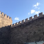
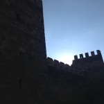
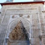
- Kayseri City, a city huge of history and full of architectonical heritage, from the Hittite, The Romans, the Bizantines, the Selcuk Dinasty, the Otoman, and the Republic Era.
-

- Kayseri City, a city huge of history and full of architectonical heritage, from the Hittite, The Romans, the Bizantines, the Selcuk Dinasty, the Otoman, and the Republic Era.
-
- Kayseri City, a city huge of history and full of architectonical heritage, from the Hittite, The Romans, the Bizantines, the Selcuk Dinasty, the Otoman, and the Republic Era.
-
- The Hamam, where I went to have a Steam Bath, a Peeling and a Massage. The first time in Turkey where people try to get a financial advantage because Im a foreigner. They don’t had luck, I was strong enough to handle with them.
-
- Kayseri City, a city huge of history and full of architectonical heritage, from the Hittite, The Romans, the Bizantines, the Selcuk Dinasty, the Otoman, and the Republic Era.
-
- Kayseri City, a city huge of history and full of architectonical heritage, from the Hittite, The Romans, the Bizantines, the Selcuk Dinasty, the Otoman, and the Republic Era.
-
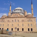
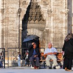
- in front of the Mosquee, while men washing their feet as a muslim tradition.
-
- Coocking Pasta at the Campsite Göreme
-
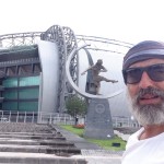
- Kayseri Soccer Arena
-
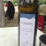
- Best turkish (red) Wine.
-
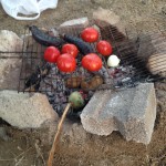
- Vegetarian Barbecuing at Göreme Camping
-
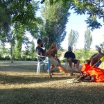
- small talking at Göreme Camping
-
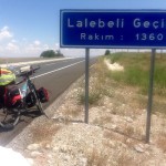
- My first pass of today heading Sivas (Part I)
-
- My second pass today, heading Sivas (part I)
-
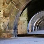
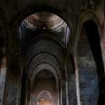
- The interior view of Sultan Han’s Caravanserai. Here the main building where travellers and their animals could rest. It was also a storage room for their goods.
-
- The interior of Sultan Han Caravanserai with the mosquee in the center of the interior courtyard.
-
- The interior view of Sultan Han’s Caravanserai. Here the main building where travellers and their animals could rest. It was also a storage room for their goods.
-
- The interior of Sultan Han Caravanserai with the mosquee in the center of the interior courtyard.
-
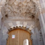
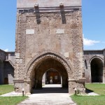
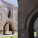
- the Portal of the Sultan Han Caravanserai along the Silk Road in central Anatolia. This Caravanserai is the second largest in todays Turkey territory after the one of Aksaray.
-
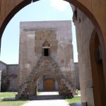
- The interior of Sultan Han Caravanserai with the mosquee in the center of the interior courtyard.
-
- https://en.wikipedia.org/wiki/Mount_Erciyes Mount Erciyes (3.990 MSL) waches over the city of Kayseri
-
- Cycle-roads in Kayseri city.
-
- Town Hall Kayseri
-
- Everything is very clean in Kayseri. Here a worker cleaning the subways stairways.
-
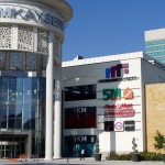
- Forum Kayseri, Central Anatolia Region, Turkey
-
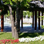
- One of uncountable city parks in Kayseri
-
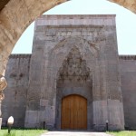
- The Caravanserai from Sultan Han (Seljuk Dynasty) build within 4 years in 1229 AD. A caravanserai (Persian: کاروانسرا) was a roadside inn where travelers could rest and recover from the day’s journey. In the Middle-East, it is often called by its Persian name khan, (خان). Caravanserais supported the flow of commerce, information, and people across the network of trade routes covering Asia, North Africa, and southeastern Europe, especially along the Silk Road.
-
- The interior view of Sultan Han’s Caravanserai. Here the main building where travellers and their animals could rest. It was also a storage room for their goods.
-
- The castel mosque – Old Town – SIVAS, Anatolia
-
- the Buruciye Madrassah in the background – Old Town – SIVAS, Anatolia
-
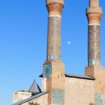
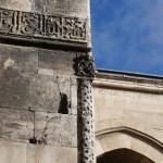
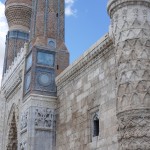
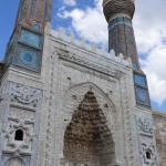
- Madrassah wit twin minarets. Old Town – SIVAS, Anatolia Madrassah’s where / are schools. Pupils studies there Calligraphy, Astronomie, Mathematics, Philosophy and of course religion, Islam, as well.
-
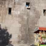
- Wood / Feet washing ritual in Islam. Old Town – SIVAS, Anatolia
-
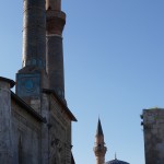
- Madrassah with twin Minarets and the Castel Mosque – Old Town – SIVAS, Anatolia
-
- BURUCIYE MADRASSAH – Old Town – SIVAS, Anatolia Madras’s where / are schools. Pupils studies there Calligraphy, Astronomie, Mathematics, Philosophy and of course religion, Islam, as well.
-
- The Madrassah wit twin minarets – Old Town – SIVAS, Anatolia
-
- Old Town – SIVAS, Anatolia
-
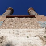
- The Madrassah wit twin minarets- Old Town – SIVAS, Anatolia
-
- Old Town – SIVAS, Anatolia
-
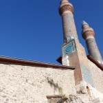
- Madrassah with „Twin MInarats“ build in 1272- Old Town – SIVAS, Anatolia Madras’s where / are schools. Pupils studies there Calligraphy, Astronomie, Mathematics, Philosophy and of course religion, Islam, as well.
-
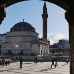
- Castel Mosque build 1580 by Sultan Murad III – Old Town – SIVAS, Anatolia
-
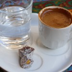
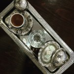
- Turkish Coffee – Old Town – SIVAS, Anatolia
-
- BURUCIYE MADRASSAH – Old Town – SIVAS, Anatolia
-
- SKY MADRASSAH – Old Town – SIVAS, Anatolia Build in 1271 is currently being restored and is planned to function as an Seljuk Museum.
-
- SKY MADRASSAH – Old Town – SIVAS, Anatolia Build in 1271 is currently being restored and is planned to function as an Seljuk Museum.
-
- Sivas Great Mosque – Old Town – SIVAS, Anatolia
-
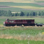
- Anatolia, Cargo Rail TCDD
-
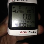
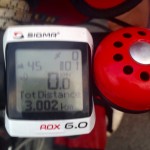
- my first 4K
-

- Statistic 30.06.2015
-
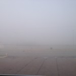
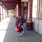
- The foggy departure
-
- Tokat
-
- Tokat
-
- The Ali Pasa Hamam (turkish bath) in Tokat.
-
- renewed old houses at Tokat.
-
- soups
-
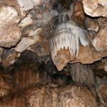
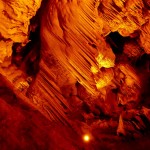
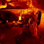
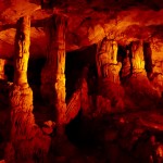
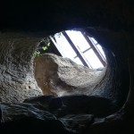
- The „Ballica Cave“ is an 8 km long cave 23 km far from Tokat, in Pazar. It is made up of crystallised karstic stone that contain 96% calcium carbonate. It is a fossil cave that developed vertically and horizontally. It has five storeys connected to each thereby stalagmites, stalactites, travertine, onion stalactites, dripstone pools and various caves formations.
-
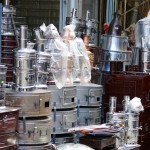
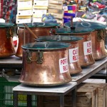
- stoves, Tea Pots and boilers
-
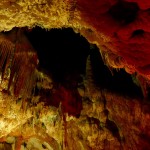
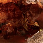
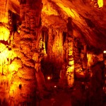
- The „Ballica Cave“ is an 8 km long cave 23 km far from Tokat, in Pazar. It is made up of crystallised karstic stone that contain 96% calcium carbonate. It is a fossil cave that developed vertically and horizontally. It has five storeys connected to each thereby stalagmites, stalactites, travertine, onion stalactites, dripstone pools and various caves formations.
-
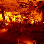
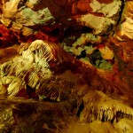
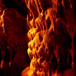
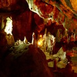
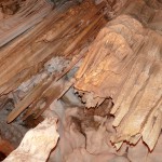
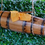
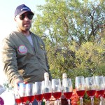
- barrel with fresh Ayran
-
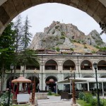
- The Stone Inn, „VOYVODA INN“ – Tasha, one of the biggest inn’s in Anatolia, build by the Ottoman in the early 17th century.
-
- Gök Madrassah. Tokat
-
- the salesman in Tashan Inn (Caravanserai )
-
- Hot green chillies
-
- The Stone Inn, „VOYVODA INN“ – Tasha, one of the biggest inn’s in Anatolia, build by the Ottoman in the early 17th century.
-
- Old houses in Tokat
-
- The Stone Inn, „VOYVODA INN“ – Tasha, one of the biggest inn’s in Anatolia, build by the Ottoman in the early 17th century.
-
- A modern neighbourhood in Tokat
-
- No, we are not in the Alps. Yeşilırmak Mountains
-
- the Yeşilırmak Mounts
-
- the first pass for today.
-
- Getting enough
-
- Mid-Size-Business in Central Anatolia.
-
- at the high plateau of the Pontic Mountains between Sivas and the Yeşilırmak Valley.
-
- Leaving Sivas and entering the Pontic Mountains.
-
- crossing the Pontic Mountains heading North.
-
- A last view back, down to Niksar
-
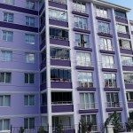
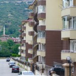
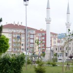
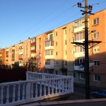
- Niksar, modern urbanisation.
-
- Niksar has been ruled by the Hittite, Persian, Greek, Pontic, Roman, Byzantine, Danishmend, Seljuk and Ottoman Empires. It has always been an important place in Anatolia because of its location, climate and productive lands. It was known as Cabira in the Hellenistic period (Κάβειρα in Greek). It was one of the favourite residences of Mithridates the Great, who built a palace there, and later of King Polemon I and his successors.
-
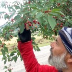
- Picking fresh cherries along the road.
-
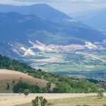
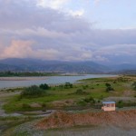
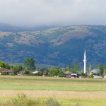
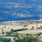
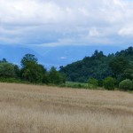
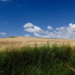
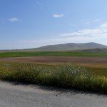
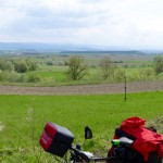
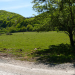
- The Canik Mountains are to the north, Dönek Mountain to the south, and the Niksar Lowland is situated between these mountains. The Niksar Lowland is one of the most important lowlands of the Black Sea Region. VIEW heading South direction Erzincan / Erzurum
-
- Niksar lands are irrigated by large and small tributaries of the Kelkit River. Forests cover 53% of the plateau, and pasture 12%; 32% of the land is devoted to agriculture, and only 3% is unsuitable for farming
-
- Niksar has been ruled by the Hittite, Persian, Greek, Pontic, Roman, Byzantine, Danishmend, Seljuk and Ottoman Empires. It has always been an important place in Anatolia because of its location, climate and productive lands.
-
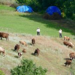
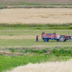
- farmers keeping their cows
-
- The Canik Mountains are to the north, Dönek Mountain to the south, and the Niksar Lowland is situated between these mountains. The Niksar Lowland is one of the most important lowlands of the Black Sea Region.
-
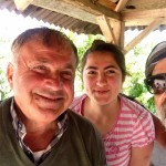
- lovely farmers offered me fresh fruits and a short rest in the shadow along the Road Number 850 between Tokat and Niksar
-
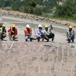
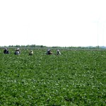
- street workers on Road Number 850 between Tokat and Niksar
-
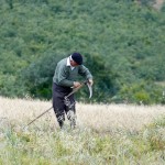
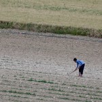
- Field worker between Tokat and Niksar
-
- Ahmed the surveillance officer at Comana Pontica
-
- Pontic Comana, is currently close to the visitor, but Ahmed from the security service was so kind and let me in and told me a lot about this place.
-
- youth checkpoint in a neighbourhood in Niksar
-
- Mahmut Coskun from Warmshowers.com in Tokat
-
- Kayseri City, a city huge of history and full of architectonical heritage, from the Hittite, The Romans, the Bizantines, the Selcuk Dinasty, the Otoman, and the Republic Era.
June 30th – 6 Wochen Türkei (Teil 3) – Region Anatolien (Kapadokkien)
-
- short of Kozanli, Central Anatolia, between province of Ankara and Konya
-
- short of Kozanli, Central Anatolia, between province of Ankara and Konya
-
- short of Kozanli, Central Anatolia, between province of Ankara and Konya
-
- Screensaver Anatolya
-
- Trying to stretch.
-
- Central Anatolia
-
- Central Anatolia
-
- Sound Check at the Muezzin in a Kurdish village, Central Anatolia
-
- Sehit, the shepherd riding his donkey.
-
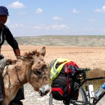
- Sehit, the shepherd riding his donkey.
-
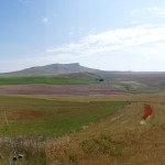
- Panoramic view, after the little kurdish villa of Inler, Ankara.
-
- South east of Inler, Ankara province, Central Anatolia
-
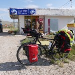
- my camp site last night at Inler. Thank you to Nihat who let me camp behind his gas station.
-
- my camp site last night at Inler. Thank you to Nihat who let me camp behind his gas station.
-
- with Burhan at Inler.
-
- preparing my dinner, my first dish on my stove
-
- lovely kurdish guys in Inler.
-
- My first dinner on my stove.
-
- after a small talk in Inler
-
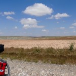
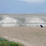
- Short of Inler at Central Anatolia. I was riding, looking for a place where to camp.
-
- yes, im exhausted. 34 degrees celsius, no trees, arid and a lot of climbs.
-
- yes, im exhausted. 34 degrees celsius, no trees, arid and a lot of climbs.
-
- and now what?
-
- no trees, drunk 4 later water, 34 C, this was a challenge.
-
- Field worker after Sivrihisar
-
- former kurdish farm house. currently they build everywhere new ones. the region shows a high recent development.
-
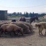
- everyone advised me about the danger of shepherds dogs. they did it so often that im currently a little bit scared about all the stories y heard.
-
- Çoraclic Göü
-
- Çoraclic Göü
-
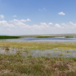
- Çoraclic Göü
-
- Field worker at Kavuncu Yaylasi, Central Anatolia
-
- 1o km south of Silvrihisar
-
- with Yenal and Sait at Sereflikochisar. Both where extrem kind. Sait owns a little market and he don’t let me pay anything. He ordered as well a lunch for me at a delivery service. It was amazing and had no words for such big gratitude. Yenal also, he went home to take his car and lead me after lunch through the city until a Hotel to rest today. Incredible friendly everyone. Thanks indeed.
-
- With Yenal
-
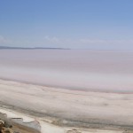
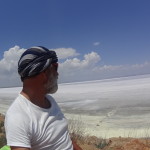
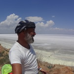
- The salt lake at Sereflikochisar.
-
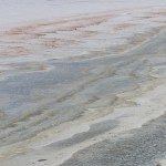
- The salt lake at Sereflikochisar.
-
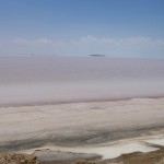
- The salt lake at Sereflikochisar.
-
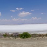
- The salt lake at Sereflikochisar.
-
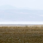
- The salt lake at Sereflikochisar.
-
- The salt lake at Sereflikochisar.
-
- A classic dinner.
-
- Random House at a Rural Village. (Bozan)
-
- The salt lake at Sereflikochisar.
-
- The salt lake at Sereflikochisar.
-
- The salt lake at Sereflikochisar.
-
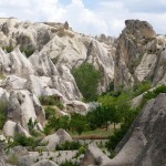
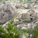
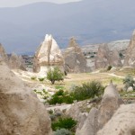
- Cappadocia (Kapadokya) The name, traditionally used in Christian sources throughout history,[citation needed] continues in use as an international tourism concept to define a region of exceptional natural wonders, in particular characterized by fairy chimneys and a unique historical and cultural heritage.
-
- The anatolian city of Selifrikochisar
-
- Çay time. A short break aside the road
-
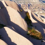
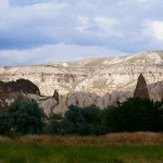
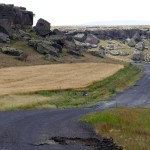
- The road between Sereflikochisar and Ortaköy. Tuffs-stone (Volcanic Stone) formations.
-
- Ü’s to sell!!!
-
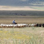
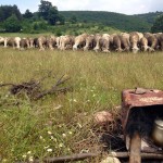
- Sheep mob in the Steppe.
-
- Village at Gökcetoprak, between Ortaköy and Göreme
-
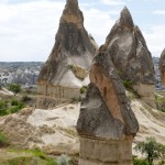
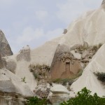
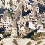
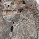
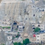
- Cappadocia (Turkish: Kapadokya) is an area in Central Anatolia in Turkey best known for its unique moon-like landscape, underground cities, cave churches and houses carved in the rocks.
-
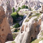
- Cappadocia (Turkish: Kapadokya) is an area in Central Anatolia in Turkey best known for its unique moon-like landscape, underground cities, cave churches and houses carved in the rocks.
-
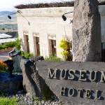
- Nice Hotels, like this Museum Hotel from Relaix & Chateau, are best integrated into landscape.
-
- Cappadocia (Turkish: Kapadokya) is an area in Central Anatolia in Turkey best known for its unique moon-like landscape, underground cities, cave churches and houses carved in the rocks.
-
- Cappadocia (Turkish: Kapadokya) is an area in Central Anatolia in Turkey best known for its unique moon-like landscape, underground cities, cave churches and houses carved in the rocks.
-
- Cappadocia (Turkish: Kapadokya) is an area in Central Anatolia in Turkey best known for its unique moon-like landscape, underground cities, cave churches and houses carved in the rocks.
-
- Cappadocia (Turkish: Kapadokya) is an area in Central Anatolia in Turkey best known for its unique moon-like landscape, underground cities, cave churches and houses carved in the rocks.
-

- Cappadocia (Turkish: Kapadokya) is an area in Central Anatolia in Turkey best known for its unique moon-like landscape, underground cities, cave churches and houses carved in the rocks.
-
- Cappadocia (Turkish: Kapadokya) is an area in Central Anatolia in Turkey best known for its unique moon-like landscape, underground cities, cave churches and houses carved in the rocks.
-
- Tuff formation arriving to Kapadokya
-
- Farm Worker at Kapadokya
-
- stall in the Kapadokya region.
-
- Landscape of Kapadokya
-
- Perfect docking on the main road of Göreme, Kapadokya
-
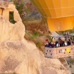
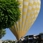
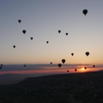
- Ballooning in Göreme, Kapadokya
-
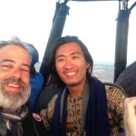
- Air-Baptism with Cpt. Tarik Aktas
-
- Göreme, Kapadokya, Central Anatolia
-
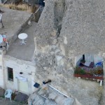
- Cave-Terrace at Göreme.
-
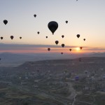
- Ballooning in Göreme, Kapadokya. The Sunrise
-
- My camp site for few days. Göreme Camping
-

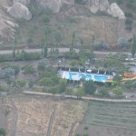
- Air View of Göreme.
-
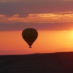
- Sunrise. Ballooning in Göreme, Kapadokya
-
- Sunrise. Ballooning in Göreme, Kapadokya
-
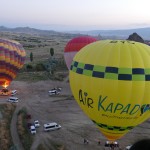
- Bravo Yankee Charly from Air Kapadokya
-
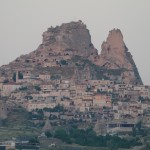
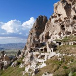
- Uhcisar, Kapadokya
-
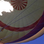
- Ballooning in Göreme, Kapadokya
-
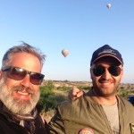
- with Cpt. Tarik Aktas
-

- Another bicycle traveller from Sweden heading China meet at the Camp Site. Ann Johansson. Follow her Blog: www.thethickwhiteline.com
-
- With Yoyo from Taiwan, we meet the first time yesterday, escaping from a rain shower in the Rose Valley.
-
- with Ashcan and Cameo at Göreme Camping
-
- Jake and Cameo
-

- enjoying at the Swimming Pool
-
- Vegetarian Barbecuing at Göreme Camping
-
- Best turkish (red) Wine.
-
- small talking at Göreme Camping
-
- Coocking Pasta at the Campsite Göreme
June 30th – 6 Wochen Türkei (Teil 2) – Region Anatolien (West)
-
- Mesut, the unknown cyclist riding in opposite direction. We hold just a small talk in german but it was nice.
-
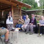
- Aksu Köyü Kadinlari Dayanişma Derneği it’s a cooperative from the woman of the village, managed from themselves.
-
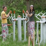
- Young members of the cooperative Aksu Köyü Kadinlari Dayanişma Derneği
-
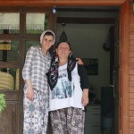
- Gülsah and her Boss from Aksu Köyü Kadinlari Dayanişma Derneği
-
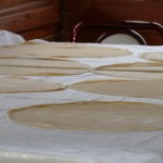
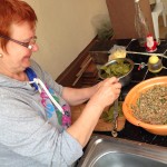
- The batter is ready to roll the Börek at Aksu Köyü Kadinlari Dayanişma Derneği
-

- this exquisite meal was offered to me by the friendly women of Aksu Köyü Kadinlari Dayanişma Derneği
-
- I was invited by this women to a meal. They managed a cooperative for women of the village baking bread and offering catering, etc
-
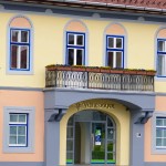
- The Kemal Atatürks Villa in Bursa
-
- A Citygarden in Bursa
-
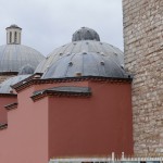
- one of several Hamams (Turkish Bads) in Bursa
-
- turkish sweets short of Bursa
-
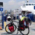
- Boarding IDO’s Catamaran from Kadiköy to Mudanya
-
- Leaving Istanbul onboard of the IDO’s Vessel to Mudanya.
-
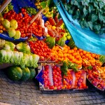
- fruit stand at Bursa
-

- Ibo playing Tavla in Istanbul
-
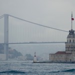
- The Bosphorus Bridge, also called the First Bosphorus Bridge or simply the First Bridge (Turkish: Boğaziçi Köprüsü, 1. Boğaziçi Köprüsü or Birinci Köprü) is one of two suspension bridges spanning the Bosphorus strait (Turkish: Boğaziçi) in Istanbul, Turkey; thus connecting Europe and Asia (the other one is the Fatih Sultan Mehmet Bridge, which is called the Second Bosphorus Bridge.) The bridge is located between Ortaköy (on the European side) and Beylerbeyi (on the Asian side).
-
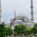
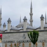
- The Sultan Ahmed Mosque (Turkish: Sultan Ahmet Camii) is a historic mosque in Istanbul. The mosque is popularly known as the Blue Mosque for the blue tiles adorning the walls of its interior. It was built from 1609 to 1616, during the rule of Ahmed I. Its Külliye contains a tomb of the founder, a madrasah and a hospice. The Sultan Ahmed Mosque is still popularly used as a mosque.
-
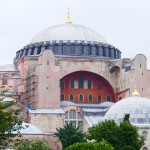
- Hagia Sophia (from the Greek: Ἁγία Σοφία, „Holy Wisdom“; Latin: Sancta Sophia or Sancta Sapientia; Turkish: Ayasofya) is a former Greek Orthodox patriarchal basilica, later an imperial mosque, and now a museum (Ayasofya Müzesi) From the date of its construction in 537 until 1453, it served as an Eastern Orthodox cathedral and seat of the Patriarchate of Constantinople, except between 1204 and 1261, when it was converted to a Roman Catholic cathedral under the Latin Empire. The building was a mosque from 29 May 1453 until 1931. It was then secularized and opened as a museum on 1 February 1935
-
- Cycling Istanbul Kadiköy
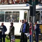
-
- Tramway at Kültür Parki Bursa

-
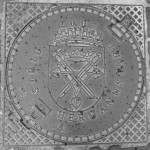
- !@#*&%^!!;>?!
-
- Eskisehir – Anatolia
-
- Eskisehir – Anatolia
-
- Eskisehir – Anatolia
-
- European who blaspheme about Turkey, like to use their markets
-
- coffeehouse in Eskisehir – Anatolia
-
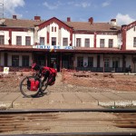
- Growing infrastructure in Turkey. Railway station in Eskisehir.
-
- Train station in Eskisehir
-
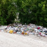
- When Turks finally learn to take care about their country and environment, this day Turkey will turn into a powerful nation again.
-
- somewhere in Anatolia (Asia Minor)
-
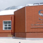
- Sport Center Eskisehir
-
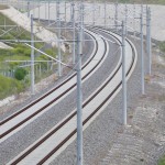
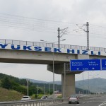
- The Turkish State Railways started building high-speed rail lines in 2003. The first section of the line, between Ankara and Eskişehir, was inaugurated on 13 March 2009. It is a part of the 533 km Istanbul to Ankara high-speed rail line. A subsidiary of Turkish State Railways, Yüksek Hızlı Tren is the sole commercial operator of high speed trains in Turkey.
-
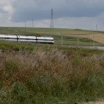
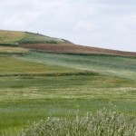
- Anatolia fields short of Eskisehir
-
- I was faced with the ruins of my life. Now, the pile of shards will bring me luck!
-
- Industrial development in Turkey, Anatolia.
-
- Anatolia / Asia Minor / Asia menor / Klein Asien.
-
- Urban development in Anatolia
-
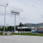
- Industrial development in Turkey, Anatolia. http://www.demirdokum.com.tr
-
- The Turkish State Railways started building high-speed rail lines in 2003. The first section of the line, between Ankara and Eskişehir, was inaugurated on 13 March 2009. It is a part of the 533 km Istanbul to Ankara high-speed rail line. A subsidiary of Turkish State Railways, Yüksek Hızlı Tren is the sole commercial operator of high speed trains in Turkey.
-
- …and then they leave
-
- the national route between Bilcic and Eskisehir. If this is a national route, I won’t imagine how a highway looks like 🙂
-
- Simplicity, a luxury everyone can afford.
-
- Osman, the friendly shepherd who invites me for a çay.
-
- He stops me on the road, open their luggage, took few hands full of cherries, gave it to me and…
-
- a little sunny village surrounded by thunderstorms.
-
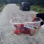
- my presents i get today on the road. fresh strawberries and cherries.
-
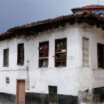
- Old mud-walled house in Anatolia.
-
- I had to choose a fresh strawberry basket.
-
- Inegöl, Old Town.
-
- Inegöl, Old Town.
-
- Inegöl, Old Town.
-
- Kurşunlu Cami Külliyesi (Mosque)
-
- Old houses in Odunpazarı (literally „wood market“ in Turkish), Oqdunpazari is a metropolitan district of Eskişehir
-
- Old houses in Odunpazarı (literally „wood market“ in Turkish), Oqdunpazari is a metropolitan district of Eskişehir
-
- Old houses in Odunpazarı (literally „wood market“ in Turkish), Oqdunpazari is a metropolitan district of Eskişehir
-
- Old houses in Odunpazarı (literally „wood market“ in Turkish), Oqdunpazari is a metropolitan district of Eskişehir
-
- Old houses in Odunpazarı (literally „wood market“ in Turkish), Oqdunpazari is a metropolitan district of Eskişehir
-
- Old houses in Odunpazarı (literally „wood market“ in Turkish), Oqdunpazari is a metropolitan district of Eskişehir
-
- Aladin Park in Eskisehir
-
- Old houses in Odunpazarı (literally „wood market“ in Turkish), Oqdunpazari is a metropolitan district of Eskişehir
-
- (Modern) Public transportation in Eskisehir
-
- Yes, I like turkish coffee. sweet if possible. It requires time and constrain you to slow down.
-
- a Çay House at Inönü
-
- a Çay House at Inönü
-
- Airsports Center at Inönü / Unfortunately y just find closed doors.
-

- Airsports Center at Inönü / Unfortunately y just find closed doors.
-
- filling up the cross words. At Inönü.
-
- Çay-House at Inönü
-
- houses at Inönü Village
-
- houses at Inönü Village
June 30th – 6 Wochen Türkei (Teil 1) – Region Marmara
-
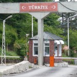
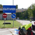
- Entering TURKEY at Malko Tarnovo Border from Bulgaria.
-
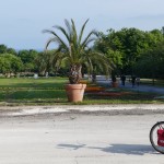
- at some PARKI in Kirklareli enjoying my „çay“
-
- at some PARKI in Kirklareli drinking my „çay“
-
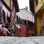
- the old town at Kirklareli
-
- small-talking at the old town in Kirklareli
-
- Kirklareli City
-
- the old town at Kirklareli
-
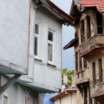
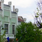
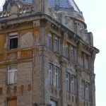
- the old town at Kirklareli with a typical ottoman villa. (currently is being renewed)
-
- the old town at Kirklareli
-
- the old town at Kirklareli
-
- the old town at Kirklareli
-
- fresh vegetables from the courtyard, since 5th century b.c. don’t need expensive „bio“ and „eco“ labels.
-
- Hızır Bey Hamamı (Turkish bad) and mosque at the background. Kirklareli.
-
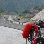
- E98 in Turkey, like a Highway for Cyclists
-
- Somewhere between Kirklareli and Vize. Let’s see the Flags tighten by the strong wind.
-
- Somewhere between Kirklareli and Vize
-
- The older man (even if younger than me) was the manager of a dining area / patio, and offered me an Ayran and Köfte and it was impossible for me to pay anything. The Turkish hospitality is indescribable. If you don’t experience it, you won’t believe it.
-
- Backgammon night with lovely guys from Vize City.
-
- Backgammon night with lovely guys from Vize City. Gökhan, Tayfun, Tolga Metin.
-
- Crossing The Yildiz Mountains
-
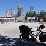
- at Pinarhisar, Cement Fabric
-
- with Gökhan at their Restaurant
-
- At Silivri / Motocamp
-
- At Silivri / Motocamp
-
- Breakfast at seaside. Motocamp, Silivri
-
- Silivri. Yes, well I mean NO! I was absolutely not motivated to bike today. It was late, hot, and I was tired.
-
- After totally 1190 meter climbs, 100 km, i finally arrived to Eminönü in Istanbul. Yilmaz, a cyclist from Istanbul lead me safe through the city and traffic until the ferry boat. Thank you Yilmaz
-
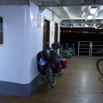
- Onboard the Ferryboat, leaving Europe at 11 PM crossing the Bosphorus to Ist- Kadiköy.
-
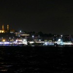
- Hagia Sophia by night
-
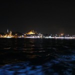
- The Bosporus
-
- 2 km past the 3K mark. somewhere in Istanbul city.
-
- Yimaz, my leader last night in Istanbul city.
-
- Moonrise at the Bosphorus
-
- Entering the 15 million city Istanbul.
-
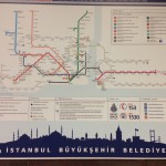
- Underground network Istanbul
-
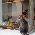
- Istanbul, the cat’s city.
-
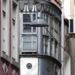
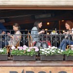
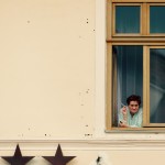
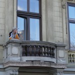
- balcony
-
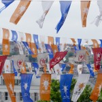
- the day before elections
-
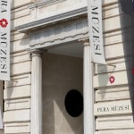
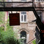
- Pera Müzesi Istanbul
-
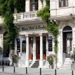
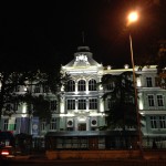
- Grand Hotel Londres – Istanbul
-
- small-talking in a bar
-
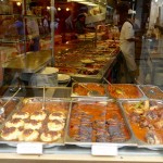
- A restaurant in Istanbul
-
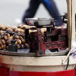
- Marroni at Iskelesi Street / Istanbul
-
- Cat’s city, Istanbul
-
- In Allahs name
-
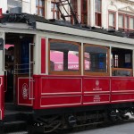
- http://www.iett.gov.tr/en/main/pages/nostalgic-tramvay/155
-
- Hot Spots on The Golden Horn
-
- Istanbul Sultanahmed / Eminönü
-
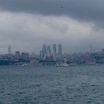
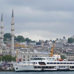
- Istanbul from the Bosphorus
-
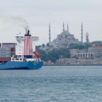
- Istanbul Sultanahmed
-
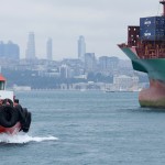
- Istanbul from the Bosphorus
May 31st – Black Sea – Romania and Bulgaria
-
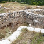
- Orgami / ARGAMUM, una Polis griega del siglo VII AC, luego un fuerte Romano (SIGLO VII DC)
-
- Estudio empírico de las ruinas. Orgami / ARGAMUM, una Polis griega del siglo VII AC, luego un fuerte Romano (SIGLO VII DC)
-
- Orgami / ARGAMUM, una Polis griega del siglo VII AC, luego un fuerte Romano (SIGLO VII DC)
-
- Laguna de Razim
-
- Enisala Fortress, Dated to the late 13th or the beginning of the 14th century, it was built to control the travel routes that passed through the region. attribute it either to the Genoese, who held several trading posts in the area, or to the Byzantines, who intermittently controlled the region.
-
- Sarichioi, a Lipovanian (former Russian immigrants) village and their Orthodox Basilica.
-
- Sarichioi, a Lipovanian (former Russian immigrants) village and their Orthodox Basilica.
-
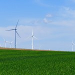
- Sustentable Energy. Windmills in the Drombuja Region. Southeast Romania
-
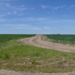
- Crossroads
-
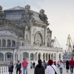
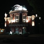
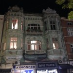
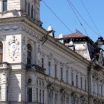
- The former Constanta’s Casino in Art Neuveau Style
-
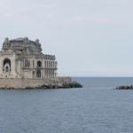
- The former Constanta’s Casino in Art Neuveau Style
-

- Should I marry should I no??????
-
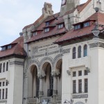
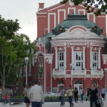
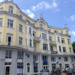
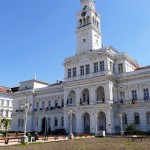
- Historical Museum Constanta (former Town Hall)
-
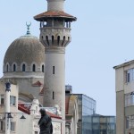
- Constanta, the Mosque from 1910 build by King Carol I dedicated to the muslims in the city. Piata Ovidiu and his Monument
-
- Daniel, the inspired Romanian _Spanish cyclist and my tour guide in Constanta and his lovely sister. (sorry forgot the name)
-
- Natalia, the mosquito and Nicola (both where my lovely hosts in this city) in an excellent* restaurant in Constanta 🙂
-
- Guillaume, Me, Natalia, Marie-Therese, Nicola at their home.
-
- Marie Therese, Becca, Guillaume, Nicola, Natalia, Floris, Me
-
- In Olymp Ressort Beach (RO)
-
- In Olymp Ressort Beach (RO)
-
- The virgin beach at the Black Sea (Costinesti)
-
- at the virgin beach on the Black Sea (Costinesti) looking for a unified taint.
-
- The virgin beach at the Black Sea (Costinesti)
-
- With Rozvan and his mother Silvia at Eforie Nord
-
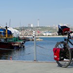
- Port of Constanta btw Gate 7 and Gate 9
-
- Bogdan’s Parents and his wife Anika
-
- For the first time, really pissed off with the worst waitress ever. (Camping Cosmos, Shabla, Bulgaria)
-
- Entering Bulgaria 20.05.2015
-
- Entering Bulgaria 20.05.2015
-
- The last Romanian Beach at Vama Veche
-
- Goodbye Romania! I love you!
-
- Last coffee break in Romania (Village 2nd of May)
-
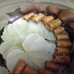
- Bogdan mum’s sarmale
-
- Bogdan mum’s sarmale preparation
-
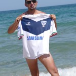
- Bogdan with his Velez Sarsfield Soccer Team Shirt from Argentina
-
- Excellent Ciorba prepared by Anika, Bogdan’s Wife.
-
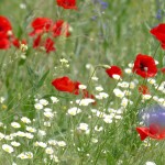
- a flowery meadow with red poppies.
-
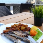
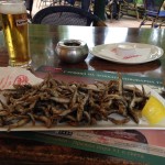
- grilled sardines
-
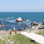
- Tyulenovo Village
-
- the fisherman
-
- dead roll monument
-
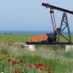
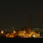
- Oil drilling
-
- everywhere obituaries. I feel that 40% of the households in Sabsha shows obituaries on their frontside.
-
- worker’s break.
-
- My stay at Kavarna / Balchik
-
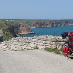
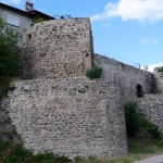
- Cape Kaliakra and Kaliakra Fortress
-
- Cape Kaliakra and Kaliakra Fortress – The former Sauna
-
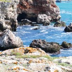
- Yailata Archeological Site
-
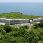
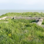
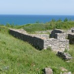
- A small fortress is situated on the northern part of the plane terrace known as the Big Yayla
-
- A small fortress is situated on the northern part of the plane terrace known as the Big Yayla
-
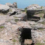
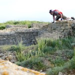
- Over 120 grave constructions were found in the three cemeteries in the Natural Reserve Yaylata; they were cut into the even rocky plateau or in the steep vertical cliffs. Several cave-type tombs were investigated on the southern terrace. They were cut into the base of the rock and consisted of small antechambers leading to rectangular burial chambers. This tombs of the Dobroudja Black Sea coast can be related to the invasion and settlement of barbarian tribes, most probably of Sarmathian origin.
-
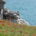
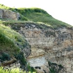
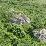
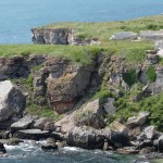
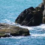
- The Cliffs at Yailata
-
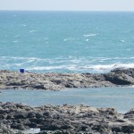
- The Cliffs at Tyulenovo
-
- The Cliffs at Tyulenovo
-
- The Cliffs at Tyulenovo
-
- Varna, The Theatre
-
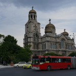
- Varna, the Orthodox Cathedral
-
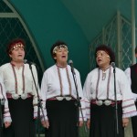
- Varna, Sea Garden, Folclore Show
-
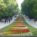
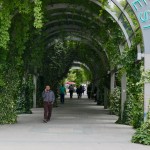
- Varna, the Sea Garden, a huge park, one of the nicest I’ve ever seen.
-
- Varna, the Sea Garden, a huge park, one of the nicest I’ve ever seen.
-
- Varna, the Sea Garden, a huge park, one of the nicest I’ve ever seen.
-
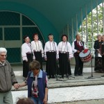
- Varna- Sea Garden, Folclore
-
- Varna Old Town – Theatre by night
-
- Varna Old Town
-
- Varna Old Town
-
- Having lunch with Viktor, the kind owner from Hostel Casablanca, invited me to taste his own made grappa and white wine.
-
- Varna Old Town
-
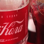
- Drink Coca Cola
-
- Obituaries in Bulgaria
-
- Obituaries in Bulgaria
-
- Eastern Balkan Mountain Range
-
- Martenitsi tied to a blossoming tree, a symbol of approaching spring
-
- Eastern Balkan Mountain Range
-
- Eastern Balkan Mountain Range
-
- Eastern Balkan Mountain Range SOLAR FARM
-
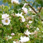
- Wild Roses, typically for Bulgaria
-
- the wonderful „SEA GARDEN“ at Burgas, between City and Beach, build in 1920
-
- The famous Pier in Burgas at the black Sea coast.
-
- the wonderful „SEA GARDEN“ at Burgas, between City and Beach, build in 1920
-
- the wonderful „SEA GARDEN“ at Burgas, between City and Beach, build in 1920
-
- the wonderful „SEA GARDEN“ at Burgas, between City and Beach, build in 1920
-
- the wonderful „SEA GARDEN“ at Burgas, between City and Beach, build in 1920
-
- the wonderful „SEA GARDEN“ at Burgas, between City and Beach, build in 1920
-
- Main Square at Burgas
-
- Cornalitos – Fried fish
-
- between Burgas and Malko Ternovo
-

- this turtle overhauled me today during one of my several climbings.
May 13th – Donau Delta und Schwarzes Meer
-
- Sunset a t Tulcea
-
- Late afternoon at Tulcea
-
- Tulcea (Romania)
-
- Tulcea
-
- La arquitectura comunista.
-
- Tulcea
-
- Tulcea Harbour
-
- Tulcea Harbour
-
- onboard to Danube Delta eating some fried bread with cheese.
-
- south branch Danube River
-
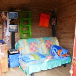
- My shelter for the next two nights at Sfantu Gheorghe
-
- My shelter for the next two nights at Sfantu Gheorghe
-
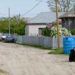
- Sfantu Gheorghe
-
- Going ashore in Sfantu Gheorghe
-
- My welcome snack at Sfantu Gheorghe. :S
-
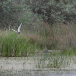
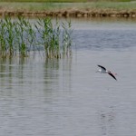
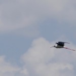
- Fauna at the Danube Delta

-
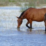
- Fauna at the Danube Delta
-
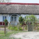
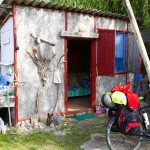
- a Lipovan House
-
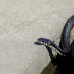
- Fauna at the Danube Delta
-
- the jetty at Sfantu Gheorghe
-
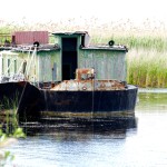
- wracks of the Danube Delta
-
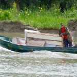
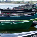
- a Lipovan Boat at Danube Delta
-
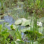
- Flora at Danube Delta
-
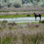
- Fauna at the Danube Delta
-
- Flora at Danube Delta
-
- Flora at the Danube Delta
-
- short of Black Sea
-
- Goal achieved, Black Sea reached.
-
- Short of the Black Sea
-
- Goal achieved, Black Sea reached.
-
- Goal achieved, Black Sea reached.
-
- Goal achieved. Reached the Black Sea
Mai den 3. – Siebenburgen, Die Stadt Kronstadt (Brasov)
-
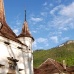
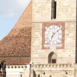
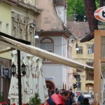
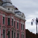
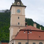
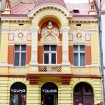
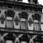
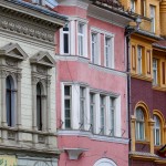
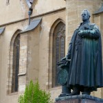
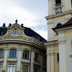
- Brasov (Kronstadt) -Fronts of the city
-
- Biserica Rupreste at Sinca Vecha. Woman is praying
-
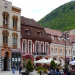
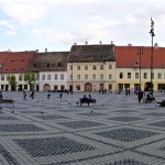
- The Main Square
-
- Brasov
-
- Simona, my walking tour guide *****
-
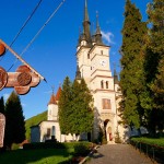
- St. Nicholas (Ortodox) Church
-
- St. Nicholas (Ortodox) Church
-
- St. Nicholas (Ortodox) Church
-
- Coffee Shop inside
-
- Coffee Shop inside
-
- Coffe Shop
-
- Brasov (Kronstadt) -Fronts of the city
-
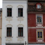
- Brasov (Kronstadt) -Fronts of the city

-
- Brasov (Kronstadt) -Fronts of the city
-
- Brasov (Kronstadt) -Fronts of the city
-
- Brasov (Kronstadt) -Fronts of the city
-
- Brasov (Kronstadt) -Fronts of the city
-
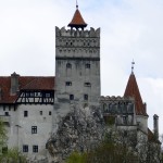
- Bran Castle or for touristic purposes: The Dracula Castle
-
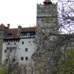
- Bran Castle or for touristic purposes: The Dracula Castle
-
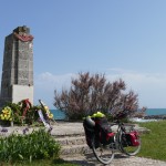
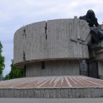
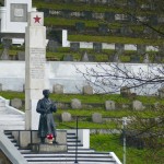
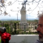
- Monument for the fallen (killed) during communism.
-
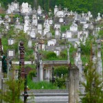
- Cementery
-
- Biserica Rupestre at Sinca Vecha (Brasov)
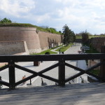
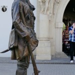
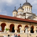
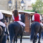
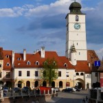
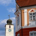
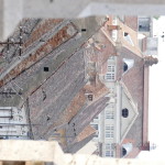
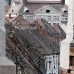
April 28th – Transilvania / Alba Iulia & Sibiu
April 21. – Der Banat
-
- Anna-Maria & Marius http://www.vila-sarada.ro a ***** Boutique House
-
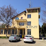
- Deva Aeroclub
-
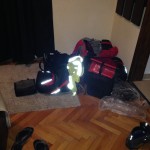
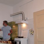
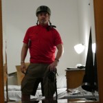
- So schaut es im Zimmer jeden Tag aus.
-
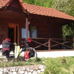
- Pensiunea Patrimara von Florin in Caprioara
-
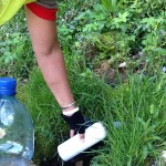
- Frischwasser aus der Quelle / Pensiunea Patrimara von Florin in Caprioara
-
- So vergeht am Vormittag für mich die Zeit. Und ab und zu ist es auch wert!
-
- Stadt Lipova (Provinz Arad) und das Kommunistische Erbe
-
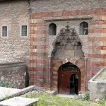
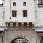
- Stadt Lipova (Provinz Arad) und der original erhaltene BAZAAR aus der Osmanen Zeit.
-
- Stadt Lipova (Provinz Arad)
-
- Stadt Lipova (Provinz Arad)
-
- Rasten und Beobachten
-
- Rasten und Beobachten
-
- Rasten und Beobachten
-
- am Horizont die ersten Ausläufer der Südkarpaten
-
- Zigeuner Villa in Arat
-
- Stadt Arat
-
- Stadt Arat
-
- Gemeinde der Stadt ARAT
-
- Eine ***** Pension in Makó
-
- entlang der MURES
April 18. – Die Puszta
-
- Fluss MURES
-
- entlang der MURES
-
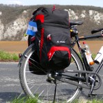
- Ein neues Accessoire
-
- Szeged
-
- Szeged
-
- Viele Tote, nur wegen Grenzen.
-
- Zeltlager ist Aufgeschlagen.
-
- Zeltlager ist Aufgeschlagen.
-

- Gegen die Unterzuckerung
-
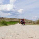
- die Puszta, am Nationalpark Bugac Puszta. Hier kreuzten Sekunden davor eine ganze Horde Wild. (Hirsch und Reh). Siehe auch den sandigen Boden. Fahrradfahren unmöglich.
-
- Heute Vormittag kurz vor 1000
-
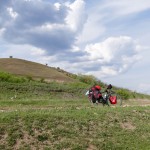
- die Puszta, am Nationalpark Bugac Puszta
-
- die Puszta, am Nationalpark Bugac Puszta
-
- at Akac-Tanya
-
- Preparing Dinner
April 13. – BUDAPEST
-
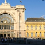
- La Gare de l“est Keleti Bahnhof
-
- Kommunistisches Nachlass
-
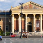
- Museum der Bildenden Künste am Heldenplatz
-
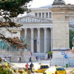
- Museum der Bildenden Künste am Heldenplatz
-
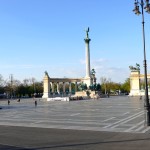
- Heldenplatz
-
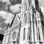
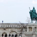
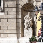
- Matthiaskirche
-
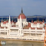
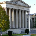
- Das Parlamentsgebäude erbaut zum „Ungarischen Millennium“ 1896
-
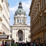
- Stefansbasilika
-
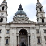
- Stefansbasilika
-
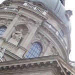
- Stefansbasilika
-
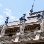
- Die Oper
-
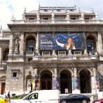
- Das Opernhaus
-
- Erkel Istvan, Komponist und Autor der ungarischen Hymne.
-
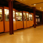
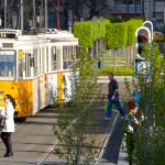
- Die Budapester Bahnen
-
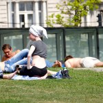
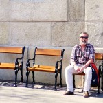
- Sunbathing in Budapest
-
- Young Budapest
-
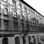
- Der Verfall der Stadt durch die Kommunisten hat bis Heute Spuren hinterlassen.
-
- Die „Blaue Donau“ war wohl nur in der Illusion des Johanns Strauss.
-
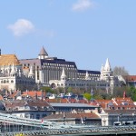
- Fischerbastei in Buda
-
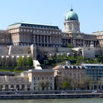
- Königlicher Palast in Buda
-
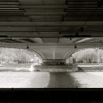
- Die Kettenbrücke verbindet Buda mit Pest
-
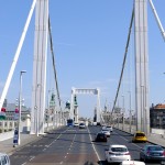
- Elizabeth Brücke
-
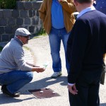
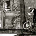
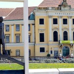
- Der Schwindler
-
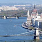
- Die Kettenbrücke über die Donau, erbaut 1849 war die erste Hängebrücke der Welt. Im Hintergrund das Parlamentsgebäude
-
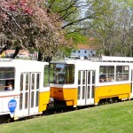
- Trambahnen
-
- Meine Freunde und ich!
-
- Volkstanz Theater
-
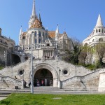
- Die Fischerbastei
-
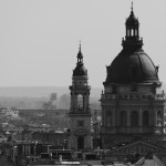
- Die Basilika des Hl. Stefans.
-
- Anfahrt auf Budapest, aus Tata kommend.
April 12th – Györ – Transdanubia – Hungary
-
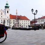
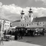
- Györ in region TRANSDANUBIA, Hungary
-
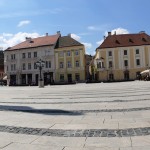
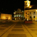
- Széchenyi Square
-

- Széchenyi Square
-
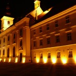
- Loyolai Szent Ignác templom
-
- Loyolai Szent Ignác templom
-
- Loyolai Szent Ignác templom
-
- Loyolai Szent Ignác templom
-
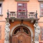
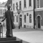
- Baross Gábor út
-
- Baross Gábor út
-
- Baross Gábor út
-
- Széchenyi Square
April 7th – Vienna

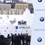
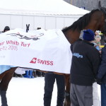
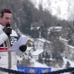
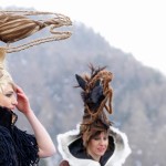
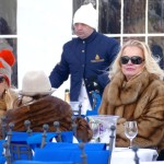
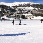
February 8th – White Turf St. Moritz 2015
-
- 150 Years / Años / Anné / Winter Tourism St. Moritz / Switzerland
-
- Me at Lej da Statz
-
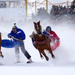
- White Turf 2015 – Lake of St. Moritz, Switzerland
-
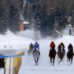
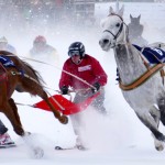
- White Turf 2015 – Lake of St. Moritz, Switzerland
-
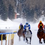
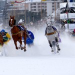
- White Turf 2015 – Lake of St. Moritz, Switzerland
-
- White Turf 2015 – Lake of St. Moritz, Switzerland
-
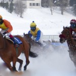
- White Turf 2015 – Lake of St. Moritz, Switzerland
-
- White Turf 2015 – Lake of St. Moritz, Switzerland
-
- White Turf 2015 – Lake of St. Moritz, Switzerland
-

- White Turf 2015 – Lake of St. Moritz, Switzerland
-
- White Turf 2015 – Lake of St. Moritz, Switzerland
-
- White Turf 2015 – Lake of St. Moritz, Switzerland
-
- White Turf 2015 – Lake of St. Moritz, Switzerland
-
- White Turf 2015 – Lake of St. Moritz, Switzerland
-
- White Turf 2015 – Lake of St. Moritz, Switzerland
-
- White Turf 2015 – Lake of St. Moritz, Switzerland
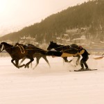
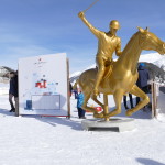
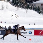
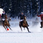
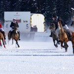
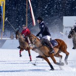
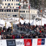
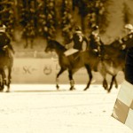
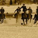
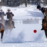
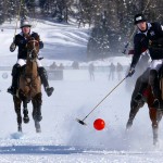
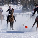
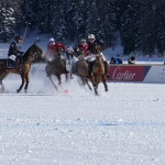
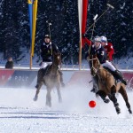
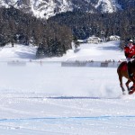
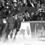
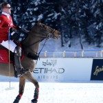
31. Januar 2015 – Winter Polo St, Moritz – Das jährliche Tournier am zugefrorenem St. Moritzer See.
-
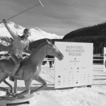
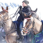
- Winter Polo St. Moritz. Das jährliche Polo Tournier auf Schnee im zugefrorenem St. Morter See
-
- Winter Polo St. Moritz. Das jährliche Polo Tournier auf Schnee im zugefrorenem St. Morter See
-
- Winter Polo St. Moritz. Das jährliche Polo Tournier auf Schnee im zugefrorenem St. Morter See
-
- Winter Polo St. Moritz. Das jährliche Polo Tournier auf Schnee im zugefrorenem St. Morter See
-
- Winter Polo St. Moritz. Das jährliche Polo Tournier auf Schnee im zugefrorenem St. Morter See
-
- Winter Polo St. Moritz. Das jährliche Polo Tournier auf Schnee im zugefrorenem St. Morter See
-
- Winter Polo St. Moritz. Das jährliche Polo Tournier auf Schnee im zugefrorenem St. Morter See
-
- Winter Polo St. Moritz. Das jährliche Polo Tournier auf Schnee im zugefrorenem St. Morter See
-
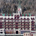
- Hotel Badrut St. Moritz
-
- Winter Polo St. Moritz. Das jährliche Polo Tournier auf Schnee im zugefrorenem St. Morter See
-
- Winter Polo St. Moritz. Das jährliche Polo Tournier auf Schnee im zugefrorenem St. Morter See
-
- Winter Polo St. Moritz. Das jährliche Polo Tournier auf Schnee im zugefrorenem St. Morter See
-
- Winter Polo St. Moritz. Das jährliche Polo Tournier auf Schnee im zugefrorenem St. Morter See
-
- Winter Polo St. Moritz. Das jährliche Polo Tournier auf Schnee im zugefrorenem St. Morter See
-
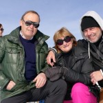
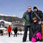
- Mit meinen Freunden Monika und Günther Sch.
-
- Mit meinen Freunden Monika und Günther Sch.
-
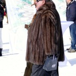
- Glamucolous – Glamurous and Ridiculous
Januar 2015 – Kann man Glück kaufen?


Januar 2015 – In dieser Umgebung bereite ich mich, sowohl technisch wie auch finanziell, auf meine Reise vor.
-
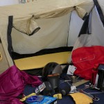
- Checking the gear
-
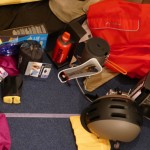
- Checking the gear
-
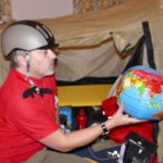
- Checking the gear
-
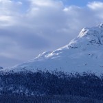
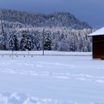
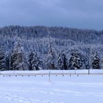
- Piz Statz
-
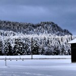
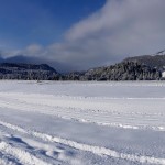
- Upper Engadin
-
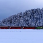
- The Raethian Railway
-
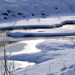
- The „Flatz“ creek
-
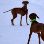
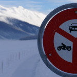
- Stop there! don’t move!
-
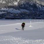
- X-Country Skiing
-
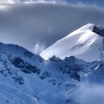
- Piz Bernina
-
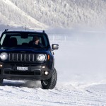
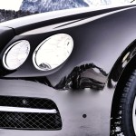
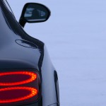
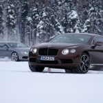
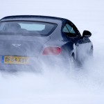
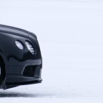
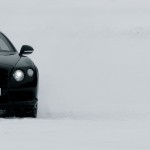
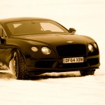
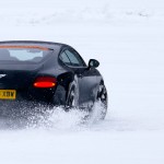
- Winter Driving Center
-

- Winter Driving Center
-
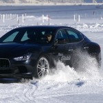
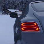
- Winter Driving Center
-
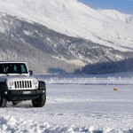
- Winter Driving Center
-

- Winter Driving Center
-

- Val Rosegg
Bitte hinterlasse eine Antwort